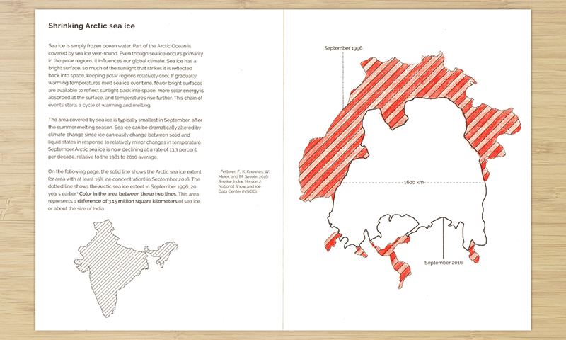
Shrinking Arctic sea ice
Color how much Arctic sea ice was lost in the past 20 years

Data sources
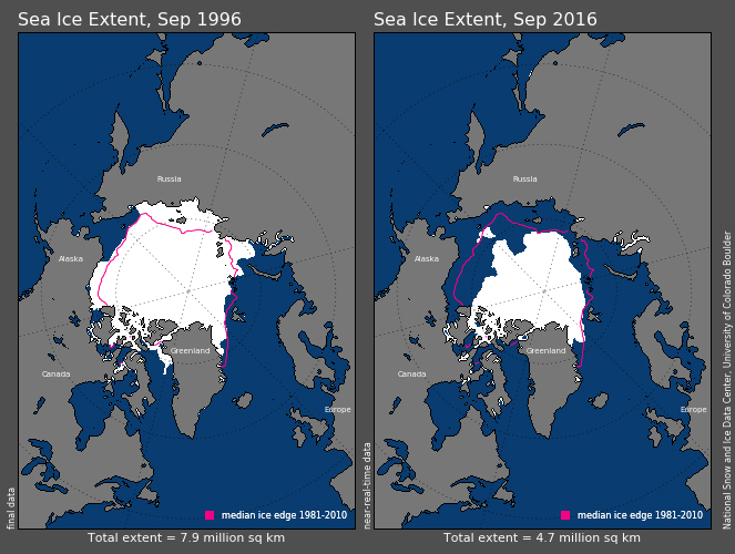
Sea Ice Index, Version 2: September Northern Extent Shapefiles. National Snow and Ice Data Center (NSIDC). Accessed December 2016. This data contains:
- The shapefiles (geospatial vector data for use in GIS software) for September 1996 and 2016 sea ice extent for the northern sea ice
- Extent defines a region as “ice-covered” or “not ice-covered” where a region needs to be have at least 15 percent ice concentration to be considered “ice-covered”
 Comparison of September 1996 and 2016 sea ice extent
How the data was used
- The largest shapes were taken for each shapefile (1996 and 2016)
- The 2016 shape was aligned and overlaid on the 1996 shape
- Based on the Arctic Sea Ice Minumum for those years, the total ice lost between that time is:
7.87 - 4.72 = 3.15 million square kilometers - For comparison, India’s land mass is 3.3 (2.9 excluding bodies of water) million square kilometers
Code
A python script is available in the code repository to generate or extend this activity, and can be run like this:
python sea_ice.py
Which will simply create an svg file with the sea ice shapes displayed. You can download additional shapefiles, place them in the ./sea_ice/data/ folder, and re-run the script like this:
python sea_ice.py -before 199609 -after 201609
Where the yyyymm corresponds to the shapefile "data/extent_N_{yyyymm}_polygon_v2/extent_N_{yyyymm}_polygon_v2"